Click to enlarge...
Do we need an introductory entry? I suppose, although the little 'about' block at top right just about sums it up, we do — if only to try out this template and figure out how to embed this, that, and the next thing. Mixing XML and HTML does not feature highly on the list of things being second nature to me.
OK, it's in the nature of the place, I guess. Cape Point Nature Reserve, that is. Most people visiting the reserve head straight to the south-western tip of Africa on the slightly claw-shaped headland hosting Cape Point, Dias Point, Cape Maclear, and the Cape of Good Hope. The rocky promontory giving the Cape of Storms its name and the reserve itself are synonymous. For many, there is little else to find there.
Click to enlarge
Until you look about you. Cape Point then becomes a fascinating mix of oft-seen, infrequently visited, and generally obscure places of magic and wonder, most often wandered by locals in search of solitude. Through this blog, we'll visit all these spots — the known and lesser known, but at a different time and pace from that set by your average tour guide.
The typical guide, it seems to this usually shabbily dressed local frequently seen stomping through the crowds thronging the parking area, appears preoccupied with getting his charges to the toilets, giving them 30 minutes to head to the replica lighthouse atop Cape Point, and hustling them down to the Cape of Good Hope — there to have their photographs taken standing behind a sign demarcating the continent's south-westernmost piece of real estate.
That's after they've surveyed the walk up to the lighthouse; have consulted whatever it is they use to tell the time, and have settled for having their pictures taken alongside a sign proclaiming baboons to be dangerous — which they're not if treated with respect.
Click to enlarge
Peter Slingsby's
excellent map of Cape Point names each promontory and marks the spot under Dias Point on which the Iranian barge, the
Shir Yib, came to rest in July 1970. More importantly, Slingsby points to the caverns under our point of focus, sea caves with which I became fascinated after taking my first photographs from the top close on three years ago. I've used a few shots of the
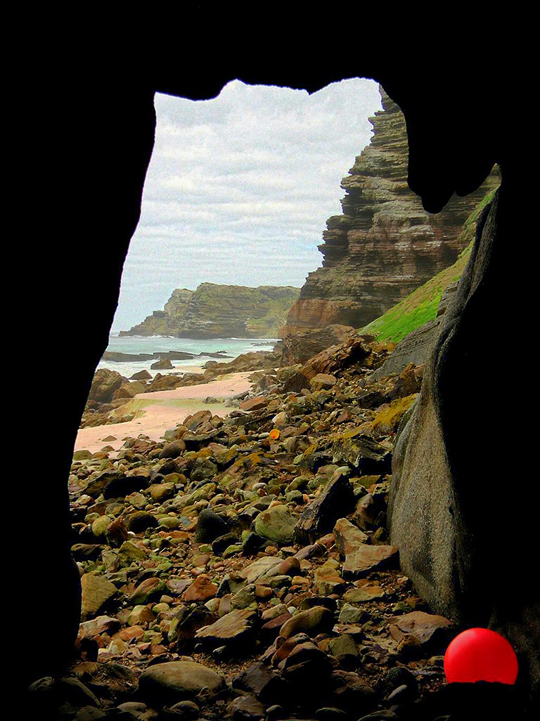
Dias Point Cave to illustrate this entry.
Over three years, I've used two digital cameras; the Canon Powershot A520 and S3 IS. Today, they're decidedly "low end" and their capabilities are far beneath those of the cheapest SLR. Which lack of capability, it should be noted, says a lot for Cape Point. It knows no technical limitations and will offer any camera stunning shots at the squeeze of a button.
Click to enlarge
Reached by way of a short walk from Dias beach on the western side, the caves, carved out of rock laid 450 million years ago, lie beneath occasionally richly vegetated, soaring sea cliffs and the replica lighthouse atop them. Because their access depends on a notoriously fickle swell, a denuded beach and the tide, Dias Point Cave offers a solitude far removed from the crowds surveying the south Atlantic from the headland above.
Click to enlarge
Although you can visit the main cave only in the best conditions — and armed with local knowledge and a low tide, there are caves and aptly contorted rock formations further towards the point. Should you be unable to visit them, chill out in the main cave, which offers a window on to an ocean over which myriad seabirds circle, swoop and glide.
Although only 45 minutes' walk from the top, the caves are usually inaccessible. Do not try to visit them. In all likelihood, you'll find yourself caught between Dias Point and Cape Point with a rising tide facing you, sheer cliffs at your back, and nowhere to hide. The sea is alarmingly powerful and often deadly.
Click to enlarge
The boom of the
Shir Yib, a proud, triangular span of heavy steel just a year ago, is today a twisted mess of flattened metal forming a featureless tangle among the gigantic rocks littering what can be an extremely inhospitable and unforgiving shore.
Must Read Dias Point Cave by Sean Houghton and Bruce Stevens in Full Circle Magazine's December 2007 issue. As for Bruce's photographs ... Eish!